Evaluating Delta CO Commercial Land Opportunities
April 2, 2026
April 2, 2026
Looking at commercial land in Delta can feel simple at first glance. A parcel may appear well located, reasonably priced, and ready for development, but the real value comes from what you can actually do with it. If you are weighing a purchase for investment, owner-occupancy, or future development, you need a clear process for judging zoning, access, utilities, and risk before you commit. Let’s dive in.
Delta is a smaller market, which can create opportunity if you match the site to realistic demand. The City of Delta had an estimated population of 9,688 as of July 1, 2024, and Delta County had an estimated population of 32,178 as of July 1, 2025, according to U.S. Census QuickFacts.
That scale matters when you evaluate absorption and end use. The city reported $289.9 million in retail sales in 2022, while the county reported $422.0 million, which points to measurable local commerce but not a market where every concept will fit. In practical terms, successful land decisions in Delta usually come from disciplined site matching, not broad assumptions about growth.
The employment base also supports a careful, fact-based approach. Delta County reported 878 employer establishments and 6,516 jobs in 2023, and Delta city reported 282 all employer firms for the 2022 reference year, based on county Census data. That is enough activity to support selected retail, service, industrial, and owner-user projects, but underwriting should stay grounded in use-specific demand.
Before you think about pricing, layout, or construction, confirm the parcel’s zoning district and future land use designation. The City of Delta makes its comprehensive plan resources and GIS tools available online, and those should be your first stop.
The city’s planning framework is especially important because a parcel that looks suitable for commercial use may still be limited by district rules. The 2021 Comprehensive Plan, adopted January 4, 2022, outlines how the city views growth corridors, mixed-use commercial areas, and industrial areas.
Delta’s Commercial Mixed-Use designation is geared toward highway-corridor locations. According to the city’s Comprehensive Plan, this designation supports a broad mix of uses such as retail, restaurants, hotels, entertainment, multi-tenant centers, and potentially some light industrial uses.
The plan ties Commercial Mixed-Use areas to B-2 and B-3 zoning. If you are evaluating frontage along a higher-traffic corridor, this is often where a lot of commercial land potential begins.
The city’s Industrial designation is meant for manufacturing, wholesaling, warehousing, agricultural product processing, and related commercial research and development uses. The same planning document maps that designation to I and I-R zoning, generally in areas near major roads and railroad tracks.
If your project depends on yard space, storage, freight movement, or production uses, industrial-designated land may be a more practical fit than trying to force those functions into a general commercial district.
Delta’s city code zoning regulations create a useful hierarchy for commercial land buyers:
In simple terms, downtown-adjacent parcels may line up better with B-1 uses, while commercial corridors often fit B-2 or B-3. Larger sites near highways, rail, or service-oriented areas may be better candidates for B-3 or industrial zoning.
A parcel with highway frontage is not automatically a parcel with easy access. This is one of the most important issues to verify early, especially in Delta.
The city notes that its Planning Commission reviews variances, conditional uses, and subdivisions, making final decisions on some matters and forwarding others to City Council. That means entitlement risk depends not only on base zoning but also on whether your use or site plan triggers additional review.
If the property touches a state highway, Colorado Department of Transportation rules may apply. According to CDOT’s access permit FAQs, an access permit may be required when the use changes, some highways require access from a lesser street or easement, and an A-line can prohibit direct access.
That can affect both cost and site design. CDOT states that commercial access permits are Level 2 at $100 or Level 3 at $300 when roadway improvements are required, and the permittee is responsible for design and construction costs for those improvements. Larger projects may also require a Traffic Impact Study.
Delta already has a long-range US 50 and SH 92 access planning framework. That plan covers future access on US 50 between Starr Nelson Road and SH 92, and on SH 92 between US 50 and 2200 Road/Austin Road.
The city has also reported improvements at the US 50/CO 92 intersection, including a second left-turn lane, a continuous raised median, signal work, and related pavement and drainage changes. For a buyer, that means you should not assume a curb cut or direct turn movement is available just because the parcel is visible from the road.
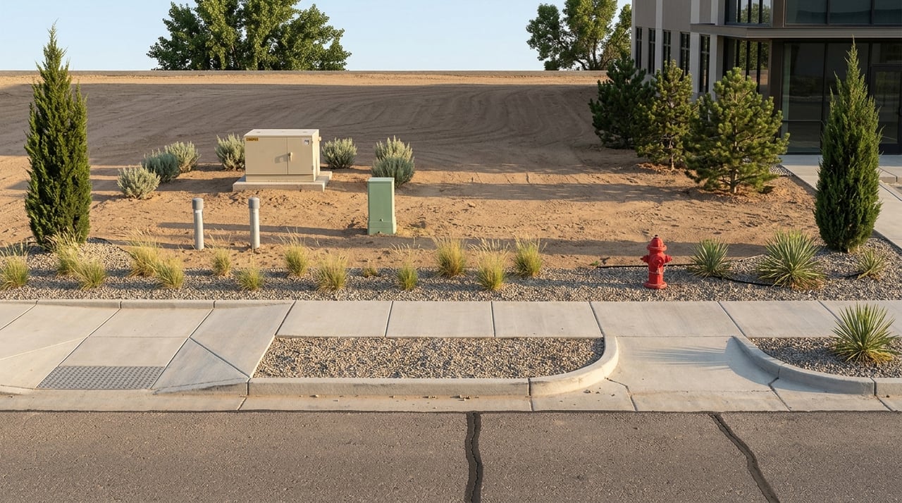
One of Delta’s stronger selling points for commercial land is utility service. The city states that it provides electric, water, wastewater, and refuse service, which can reduce uncertainty compared with more rural sites that need private systems or major off-site upgrades.
The city reports that Municipal Light & Power includes 49 miles of high-voltage lines, 4.7 miles of transmission lines, 3,449 electric meters, and two substations in town. Natural gas is provided by Black Hills Energy, and the city also notes that the utility system includes an independent power plant and wastewater treatment plant.
That does not mean every parcel is plug-and-play. You still need to verify line proximity, capacity, tap requirements, and any extension costs, but city-served infrastructure is a meaningful positive when you compare sites.
Delta’s GIS maps are a strong starting tool for parcel review. You can check zoning, streets, utilities, and flood-related layers in one place, which helps narrow down viable sites quickly.
Just be careful not to treat GIS as final proof. The city clearly states that GIS data are provided as-is and should not be used to establish title, exact boundaries, easements, or right-of-way limits.
That means your underwriting should still include:
For serious buyers, GIS is the first screen, not the final answer.
Nearby development patterns and public investment can shape how a commercial site performs over time. Delta’s planning documents note that Commercial Mixed-Use areas are intended to be visually attractive from highways and to serve both local and regional consumers.
Recent planning staff reports cited by the city also note that nearby properties in some growth areas are designated Commercial Mixed-Use, that those areas have trended toward more commercial development, and that adjacent non-residential PUDs such as Walmart and Delta Center have helped make B-2 and B-3 dominant nearby commercial districts. Another staff report notes that the East Delta Industrial Park approval from 1975 has not changed since.
Downtown is also worth attention. The city’s Main Street Project covers a 13-block downtown corridor, and the city says it received a $13.1 million RAISE grant for street reconfiguration, drainage, pedestrian access, and landscaping.
If you are evaluating land or redevelopment sites near the core, that level of public investment may support visibility, circulation, and long-term redevelopment momentum.
Floodplain review should happen near the start of your due diligence, not at the end. This is especially important for sites near the Gunnison River, Uncompahgre River, or other low-lying areas.
The city’s flood protection page states that FEMA issued preliminary FIRMs and Flood Insurance Study reports in January 2025, with an appeal period that ran through April 30, 2025. The city links both current and preliminary map resources, making this a key step in site screening.
A parcel with flood exposure is not automatically unusable, but it can affect building placement, insurance, engineering, stormwater design, and total development cost. You want those answers before you finalize pricing assumptions.
If you want a simple framework, focus on whether the site clears five core tests. The best commercial land opportunities in Delta are usually the ones where these factors line up cleanly.
Use the city’s zoning map resources and code to verify what is allowed by right and what may require additional review.
Make sure the city’s long-range planning direction supports your intended use. A project that aligns with future land use often has a smoother path than one that conflicts with it.
If the parcel fronts a state route, confirm access status with CDOT before you assume driveway placement or turning movements.
Identify whether electric, water, wastewater, and gas service are available at the site and whether capacity or extension issues could affect cost.
Screen floodplain exposure, easements, and right-of-way constraints early so you do not overvalue a site based on gross acreage that is not fully usable.
In a market like Delta, commercial land value is closely tied to execution. A site is only as good as its zoning fit, access pattern, utility readiness, and development path.
That is why a valuation-led approach matters. When you look beyond list price and focus on entitlement risk, use restrictions, and real development costs, you can make better acquisition decisions and avoid surprises later in the process.
If you are evaluating commercial land in Delta and want a practical, data-forward perspective on site fit, underwriting, and next steps, connect with GSD Broker Team. Their Western Colorado market knowledge and valuation-driven approach can help you assess opportunities with more clarity and confidence.
Stay up to date on the latest real estate trends.


Whether you are looking for business acquisitions, commercial investment or your dream home in Mesa County or surrounding areas, we’re here to help you move forward with clarity and confidence.